Territory
The Cavour Bed & Breakfast is located in Gioia del Colle, an Apulia town from which you can easily reach the nearby tourist areas:
Monte Sannace
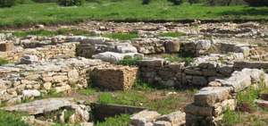
About 5 km far from the town centre, Mount Sannace hosts archaeological excavations bringing to light the remains of a Peucezian village dating back to the VII century B.C..
The origins of Gioia date back to the Byzantine rule then pass under Norman Richard Count of Altavilla. Frederick II was responsible for the final reconstruction of the castle.
Norman Castle at Gioia del Colle
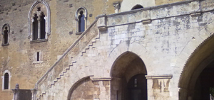
The present Norman-Swabian Castle of Gioia del Colle is the result of at least three construction operations: one dating to the Byzantine period, another to the Norman and the last one to the Swabian time.
Initially it consisted of a fortified enclosure in stone ashlars. In the 12th century it was enlarged by the Norman Richard Siniscalco, who changed it into a noble residence.
The final arrangement of the castle was made by Frederick II of Swabia around 1230, when it gained a quadrangular courtyard, halls and rooms overlooking it, and four corner towers.
Of the original four corner towers, which two local architects Honofrio Tango and Gennaro Pinto referred about, only two are still standing: the De Rossi’s and the Empress’s one.
At present the castle is the seat of the National Archaeological Museum.
Churches of Gioia del Colle
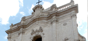
There are numerous churches in the town.
Mother Church - Saint Lucia - Immaculate Conception - Sacred Heart - Saint Vito Martyr - Saint Rocco - Saint Francis – Saint Angelo – Saint Andrew – Saint Domenic - Saint Vitus .
The historic centre of Gioia del Colle
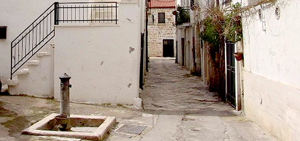
The old town of Gioia del Colle is a formally unified urban structure, compact and respectful of the different urban individualities. It results from an additive process of "single units", characterized by autonomy and intrinsic qualities and relational space, which is the result of a slow process of morphological development. Its formally homogeneous appearance connotes it compared to the modern city.
The morphogenesis of the old nucleus of the town was determined by a process of winding the Norman-Swabia Castle and by the constitution of a physical border (the walls), replaced by a ring of nineteenth century buildings, according to the principles of the planning of the bourgeois city, in order to hide the old centre consisting of a poor urban fabric still existing inside the town.
The settlement system is formed by the aggregation of building types that, at random distribution, led to a succession of courtyards and irregular road network, mainly characterized by the presence of short arches and architecturally modest addition of housing types on form with open-cell rooms (sottano on the ground floor, soprano on the first floor).
The ancient town centre should therefore be preserved, restored and valued, emphasizing its unique spatial aspects and details as the historical memory of various cultural values.
Arches of the town
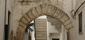
There are arches that, rather than act as a closure with door through which you enter the court, are barrel vaults holding a house above. Even these arches are intended to enter a wide area.
Some of the arches, and the oldest stone ones are of particular architectural merit, others in tufa built in more recent times, form the basis of above building and are not particularly valuable. Among these we mention: Arch St. Nicholas, Arch Paradise, Arch Vico Spada, Arch Vico Sardella, Arch Vico Serpent, Rainbow Arch, Arch Marsh Street.
The first nucleus of Gioia del Colle dates back to the Byzantine and Norman age during the high medieval time.
Bari
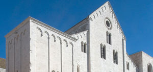
It is known for being the city where lie the relics of St. Nicholas. This privilege has made Bari and its Basilica the centre favoured by the Orthodox Church in the West.
Bari has a solid mercantile tradition and has always been a focal point within the trade and political and cultural contacts with Eastern Europe and the Middle East.
Its port is now the largest passenger port in the Adriatic Sea. From 1930 the Fiera del Levante is held in Bari, and more recently the city has become home to the Secretariat for the Pan-European Corridor No. 8.
Monopoli
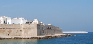
Between the coastal towns of Puglia, Monopoli is one of the most active and populous ports in the region on the Adriatic. Its old town centre of early medieval origin, superimposed on the remains of a rich Messapico village fortified as early as the fifth century B.C., overlooking the sea, is surrounded by high walls. Monopoly is also known as the city of a hundred lands.
The countryside is in fact divided into various places named districts, whose place names recall ancient disappeared hamlets, the presence of a farm, a church or other historical and geographical references are left . The coastline, about 13 km long, is low and indented with beautiful bays and over 25 large stretches of sand being ideal for swimming and exploring the underwater life.
The districts of the city, many of which are now included within the town, are characterized by the presence of ancient fortified farmhouses (centres conducting agricultural activities), churches, rock dwellings, trulli, neoclassical villas and farmhouses.
Caves of Castellana
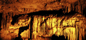
The caves of Castellana is both a complex of underground caverns of karst origin and a site of tourist interest. Located in the municipality of Castellana Grotte, in the province of Bari, about 2 km from the town. Attached to the cave complex there is a museum.
In the past it was known only to the first cavity of the huge complex, called the ravine, used by farmers as a deposit because they thought it was the mouth of hell. Animals fell into the cavity, and a fall so high surely led to the death. And the death of animals caused bad smell coming out from the cavity. In addition, the corpses of animals produced gas, which getting in contact with the exterior cold wind were sent back into the cavity.
Owing to this process farmers believed that the gases were the souls of the dead gone to hell where they tried to get out of , but were driven within by ambiguous forces. The first exploration was made in the late eighteenth century by some local young people, who stopped a few meters after the wide entrance. The discovery of the entire system of chasms and caves that make up the complex dates back to January 23, 1938 by the spelunker Franco Anelli after a campaign of caving research conducted in south-eastern Murgia promoted by Provincial Tourist Bureau, Bari.
The underground cavies extend for a length of about 3 km, reaching depths of about 72 meters below the ground level, referred to the entrance to the cave. The visit to the tourist complex is possible through two routes: the short one, about a mile which lasts 50 minutes, and the full one in about 2 hours. The natural entrance is represented by an enormous chasm 60 meters deep called the ravine in the local dialect. From here you can reach the white cave.
Alberobello and its trulli
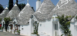
Alberobello (Silva Arboris Belli in Latin, Ajarubbedde in the local dialect), is an Italian town in the province of Bari, Puglia, in the middle of Valle d'Itria and the Murgia of Trulli. Famous for its houses, called trulli that, since 1996, are UNESCO World Heritage Site, is part of the Valle d'Itria.
Trulli
The history of these very special buildings is linked to an edict of the Kingdom of Naples in the fifteenth century, which underwent a tribute to every new urban settlement. The counts of Conversano, owners of the land on which Alberobello is located today, imposed the farmers sent to these dry lands to build their homes without using mortar, so that they could take the form of poor constructions, easy to be demolished.
Having to use only stones, the farmers found in a round shape with a self-supporting domed roof, made of overlapped stone circles, the simplest and solid form. The domed roofs of the trulli are embellished with decorative pinnacles, whose shape is inspired by the symbolic, mystical and religious references.
They were made by the workers engaged for the construction of the trullo and identified the artisan. Depending on the form of the pinnacle you could identify not only the skill of the manufacturer , but also the value of the building. A high cost in the construction of the trullo allowed to distinguish, therefore, the wealthy families from the less wealthy ones.
The symbols painted on the roofs of the trulli often take a religious meaning, they can sometimes be signs of the zodiac too. Pinnacle and symbol painted together formed a kind of civic identity, since, for a long time, Alberobello has been denied the official recognition by the Counts of Conversano.
La Valle d'Itria
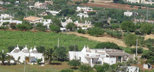
The Valle d'Itria is a portion of the central area of Puglia, between the provinces of Bari, Brindisi and Taranto. Its territory coincides with the southern part of the Murgia plateau: actually it is the karst depression which stretches between the towns of Locorotondo, Cisternino and Martina Franca.
The main peculiarity of the valley are the trulli, typical and unique cone-shaped stone houses.
It is also characterized by the presence of karst caves including the famous Castellana caves.
Fasano
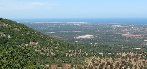
Fasano (Fascione in the local) is the center of an imaginary triangle whose vertexes are the cities of Bari, Brindisi and Taranto, distant about 50 km from Fasano, the city marks the border between the Land of Bari and the Salento.
The name "Fasano" probably comes from "Faso", an ancient name of a large white dove (presented on the coat of arms) drinking from the so-called "fogge", that is swamp or pond where water from the hills drained.
Above these fogge today is located the municipal gardens. Zoo Safari Fasanolandia, is the largest wildlife park in Italy and one of the largest in Europe.
Castel del Monte
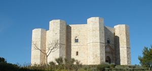
Castel del Monte is a XIII century building constructed by the Emperor Frederick II in Apulia, in the homonymous hamlet of the town of Andria, near Santa Maria del Monte 18 km from the city.
It is situated on a hill of Western Murgia, 540 meters above sea level.
In 1936 has been listed as an Italian national monuments and the UNESCO World Heritage Site in 1996.
The building has an octagonal plan (outer side: 10.30 m interval between the towers , each tower diameter: 7.90 m) and each corner joins an octagonal tower too (side 2.70 m), while the octagon corresponding to the inside courtyard has sides measuring from 6.89 m to 7.83 m.
The diameter of the inner courtyard is 17.86 m. The diameter of the entire castle is 56 m, while the diameter of each tower is of 7.90 m. The towers are 24 m high slightly over the height of the walls of the courtyard (20.50 m).
I Sassi di Matera
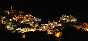
The Sassi of Matera are the centre of the city of Matera. The Sasso "Caveoso" and Sasso "Barisano," with the quarter "Civita", form a complex urban centre. Sassi of Matera were listed in the UNESCO World Heritage Site in 1993. They were the first listed site in southern Italy.
The recognition was due to the fact that they represent a unique urban ecosystem, capable of perpetuating ways of living in the caves from the prehistoric past to modern times.
The Sassi of Matera is an outstanding example of careful use in time of natural resources: water, soil, energy.
In the report of the committee of UNESCO of the evaluation criteria Matera meets the following points: the city of stone, the old town of Matera dug near the ravine, as been actually inhabited since at least Paleolithic age. Some of the artifacts found there date from the thirteenth millennium B.C., and many of the houses that dug deeply into the limestone and compact sweet limestone of the ravine, have been without interruption since the Bronze Age (apart from the forced displacement in the fifties ). The first definition of Sasso as a stony village dates back to a document of 1204. The Sassi of Matera is a settlement resulting from various forms of civilization and human activity occurred ages.
From the prehistoric village of the Neolithic period, to the habitat of the rupestrian Eastern civilization (IX-XI century), which is the urban substratum of Sassi, with its walkways, pipes, tanks, of the Norman- Swabian civilization (XI-XIII century), with its fortifications, with subsequent Renaissance expansion (XV-XVI century) and urban Baroque accommodations (XVII-XVIII century) and, finally and the first half of the twentieth century social hygiene degradation, up to the displacement past with the national law in the fifties, until the current recovery began from the 1986 law.
Taranto
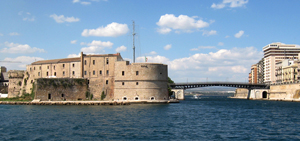
It is the seat of a large industrial and commercial port, an arsenal of the Italian Navy, and the greatest naval station.
There is also an important industrial centre, ranging from iron and steel works (including the largest iron and steel center of Europe, ILVA),to petrochemicals, cement and shipbuilding.
It is also active in the liquor industry. The main activities of the province are agriculture, fisheries, industry in the aeronautical, chemical, food, textiles, crafts, woodworking, glass and ceramics.
Brindisi
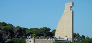
Important centre in southern Salento, the city has played an important role in history trade and culture, due to its favorable position to the Far East and its natural harbor on the Adriatic Sea. The municipality is a member of the vast area of which Brindisi is the leader.
The city also hosts a significant port for trade and transport to Greece and the Middle East. Bustling industrial centre of the Salento peninsula, Brindisi is active in agriculture and industry, especially chemical and energy. With a value added per capita in 2009 amounted to 25,037 euros Brindisi occupies the fifth place among the towns of Puglia.
Ostuni
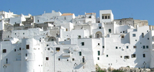
Ostuni also known as the White City, because its old town was once entirely painted white with lime, now only partially. Along with Taranto and Santa Maria di Leuca, is one of the highest ideals of the Salento peninsula.
Famous tourist centre, in 2008, 2009, 2010, and 2011 received the Blue Flag and five sails of Legambiente for the clean waters of its coast and the quality of services offered. In 2005, moreover, the Puglia Region has recognized the town as a "resort".
Source: Wikipedia


